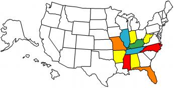
After finding this weekend was Charmayne's last full free weekend before marching band season begins in full gear, we left yesterday morning for Kentucky. The weather was very cooperative throughout the day for once while we road through some great roads. It always amazes me though how nice most of the roads are in that state and I have a couple of new favorites that I want to ride on again. Both KY-599 just east of Mount Sterling to its end back on KY-11 and KY-52 between Beattyville and just east of Richmond presented many nice turns and scenery.
Once we got to the park, the staff was very helpful with getting Paul on the sky lift putting his wheelchair on a lift chair before us and helping us put him in it at the top. The terrain at the top was a bit challenging for us to push him through but a few people were willing to stop and help us pick it up over a couple of tree roots. The girls went off an explored the area some but due to Paul's limitations we all agreed they would need to make a separate trip later to do much more.
We covered about 430 miles yesterday having left the house at 9 and getting back about 1130pm. It amazed me that 74 degrees felt as cold as it did after the sun went down and I had to buy a long sleeve shirt.
One of my favorite Ohio roads - OH-763 between south of Russellville and Aberdeen OH. This road doesn't have a shoulder on the ride side in many areas and really no place to pass anyone. Therefore, I was pleasantly surprised when a pickup that pulled out of his driveway was nice enough to pull over and let me pass him when I dropped back.

Kentucky 599 right before hitting a couple of downhill hairpins

Paul's chair riding up in one lift chair while he and I on the other.


The large rock below us in this next picture has become a collection point for hair ties

Paul on top of the bridge while the other kids walked on


Cheyenne (turned 14 on Friday) and Charmayne in the first while Justin, in the green Teenage Mutant Ninja Turtle shirt, walked through the narrow gap. As much as I liked the way they made the trail through the gap, some sort of "traffic management" would be nice so people know when others are coming through from the opposite end


Comment